
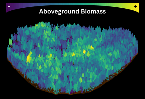
Airborne lidar is used to segment individual trees, and survey data is used to estimate aboveground biomass for each tree across large landscapes across a variety of ecosystems.

Individual tree- and shrub-level aboveground biomass mapped across multiple NEON sites. These sites include non-forest systems, such as the ONAQ desert shrubland site, which have low biomass density but are spatially very extensive!
Left: Site-level maps. Center: ortho-imagery for context. Right: crown-level aboveground biomass.
High-resolution aboveground biomass mapping - uncertainty and quantification
In projects funded by Google and NASA, we are building data products and processing frameworks for benchmarking satellite-based aboveground biomass products using airborne lidar, statistical modeling, and field-based forestry. These data products will sharpen our understanding of carbon budgets and which ecosystems are most significant for these budgets. We are also building frameworks for propagating uncertainty from allometry to satellite-pixels.
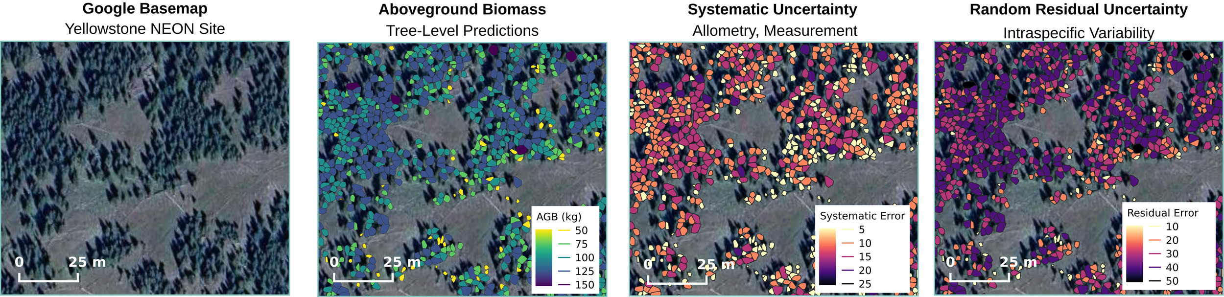
Characterizing and propagating uncertainty across tree level predictions of biomass is essential for improved estimates of carbon budgets. We are developing tools to rigorously carry forward these estimates of uncertainty across scales.